
Agricultural drones get smarter for large farm holdings
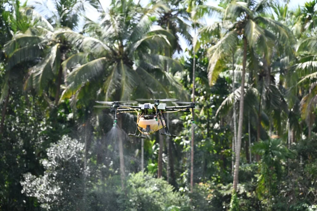
Singapore-based DroneDash Technologies and GEODNET have formed a joint venture to be called GEODASH Aerosystems, to build an agricultural spraying drone for large industrial farms. The companies say the near-production drone technology is designed to remove the need to map a field to be treated before each flight, and the need to rebuild flight plans when conditions on the ground have changed.
The aircraft will be capable of perceiving its surroundings during flight, adjust behaviour in response to visuals it captures, and undertake crop spraying.
Current agricultural spraying drones were adapted from general-purpose models developed outside the industry, which meant that on farms, human operators had to survey and map each field, generate a flight plan for each spraying operation, and repeat the mapping process when canopy conditions altered. The technology is designed to be cost-effective on very large estates, especially palm oil plantations where crops are planted in rows, this necessary preparation and adjustment times can limit how much land a team can cover.
GEODASH says its platform is built to remove the need for such preparation stages. The drone will combine DroneDash’s AI vision system with GEODNET’s positioning correction tech to achieve accuracy down to one centimetre. The drones can interpret rows, trees, terrain, and zones of operation while in the air. They are capable of adjusting their altitude and spray rates as conditions vary.
The dividing line in smart robotics is whether machines can act in changing environments. Structured spaces – assembly lines, warehouses, etc. – present simpler operating parameters. However, in the case of agriculture, real-time decisions need to be made autonomously. Agricultural land, particularly plantation terrain with mixed-age crops and changing plant growth, means drones have to recognise all relevant physical features and alter flight paths or treatment patterns according to unpredictable conditions.
In this sense, the perfect agricultural machine would need to combine the abilities of perception and location, and be able to attenuate its operations according to environmental conditions. Deterministic systems are less suited to these types of use case, as every edge-case of random occurrence can’t be hard-coded.
GEODASH Aerosystems’ proposed solution isn’t a fully unsupervised machine that can make its own decisions anywhere on a farm property, but it will be capable of operating without pre-existing maps inside geo-fenced boundaries. It will also be able to log each decision in case of the need for adjustment by operators to get the best results.
The nature of agriculture (and the natural world more generally) is that replanting, pruning, soil erosion or a host of other changes can make static maps increasingly less accurate over time. A platform that can be redeployed quickly after environmental changes could be more useful than one that’s only as accurate as its last survey data.
The companies say each flight will feed data to DroneDash’s AI Smart Farming backend, providing metrics on canopy density analysis, stresses and anomalies, plant health scores, spray-effectiveness checks, and terrain profiles. Each drone will therefore have a dual-purposes: as a spray applicator, and what’s effectively an aerial sensor platform. Data gathered could be used on an ongoing basis by farm operators, perhaps to informing of the need to change dosages, change treatment timings, flag the need for fertilisation or pest control, and inform replanting schedules.
GEODASH is aiming its technology initially at palm oil plantations in Southeast Asia, row-cropping operators in the US, and large estates in South America. The companies say they ran pilot deployments and validation projects throughout 2025 and into early 2026. Commercial deployment by GEODASH Aerosystems is planned for the third quarter of 2026.
“Agriculture does not need bigger drones – it needs smarter ones,” said Paul Yam, CEO, DroneDash Technologies and GEODASH Aerosystems.
(Image source: “Agriculture drone new technology” by Shreesha Sharma is licensed under CC BY-SA 4.0. To view a copy of this license, visit https://creativecommons.org/licenses/by-sa/4.0)
Want to learn more about AI and big data from industry leaders? Check out AI & Big Data Expo taking place in Amsterdam, California, and London. The comprehensive event is part of TechEx and co-located with other leading technology events. Click here for more information.
AI News is powered by TechForge Media. Explore other upcoming enterprise technology events and webinars here.